
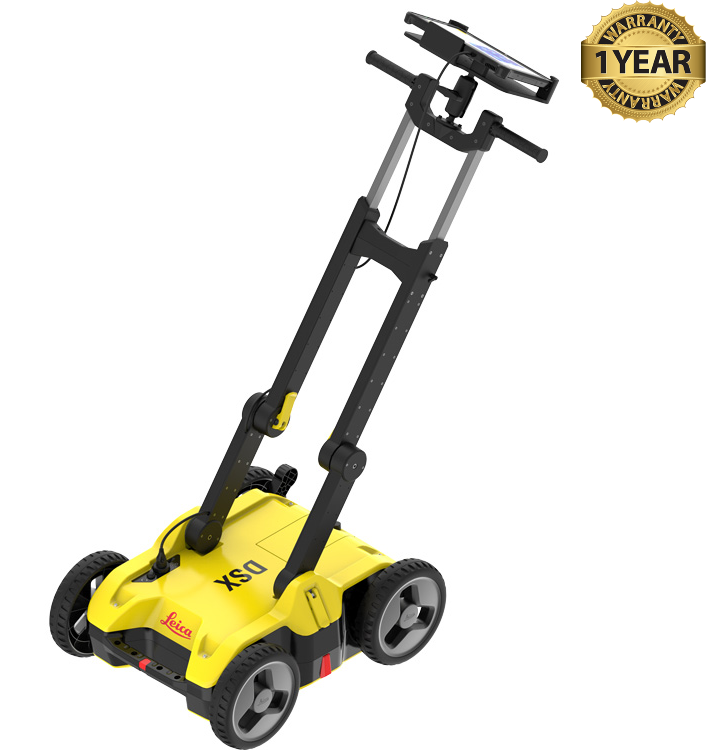

Leica DSX DXplore Utility Detection Radar GPR
Condition: Refurbished / Calibrated
Warranty: 1 Year Warranty
Shipping: USA & Worldwide
- Leica DSX DXplore Utility Detection Radar GPR: (BC# -L/T*)
- CT1000 Tablet Controller w/ Leica DXplore Software (BC# -L/T*)
- Battery Charger
- AC Adapter
- Power Cable
Leica DSX DXplore Utility Detection Radar GPR
The Leica DSX GPR is an advanced tool for accurate and efficient underground detection. With its cutting-edge technology, it delivers reliable results instantly. Its ergonomic design and ease of use make it an ideal solution for construction professionals, engineers and archaeologists.
With the CT1000 tablet controller and DXplore software, allows users to locate, visualize, and map underground utilities quickly. The ground-penetrating radar (GPR) of the DSX is made more effective and efficient thanks to the state-of-the-art software. DXplore software takes the effort out of data analysis by automating the process and creating a 3D map of the scanned area.
The Leica DSX combines ground penetrating radar (GPR) with global positioning technology (GPS) to provide detailed and accurate visualisation of subsurface features. It can detect pipes, cables, metal structures, cavities and other buried objects, helping to plan projects and prevent damage.
The utility detection radar detects and positions both shallow and deep targets simultaneously, gathering quick information. It has a dual-frequency (250 and 700 MHz) perpendicular antenna orientation that makes detection easier. It can acquire data more than 10 km/hr, ideal in site construction, excavation and utility mapping.
Underground services locations can be tied into existing workflows using Leica GNSS, total station and machine control systems. Users of the latest Leica machine control iCON MC1 have the added advantage that 3D services maps can be imported directly from the Leica DSX without the need for third party software.
Machine operators can then create 3D avoidance zones around identified services directly on the control panel to minimize the risk of strikes. Reliable utility detection for everyone simple detection workflow and results that anyone can be easily understood.
For utility repair and maintenance, civil engineering and surveying companies, the Leica DSX utility detection solution, consisting of a portable hardware with intuitive software enabling the user to easily locate, visualize and map utilities. Unlike any other ground penetrating radar (GPR) system, the Leica DSX maximizes productivity with cutting-edge software that automates data analysis and creates a 3D utility map on the field.
Leica DXplore Software
Leica DXplore is an intuitive, on-board software designed for the Leica DXplore ground-penetrating radar (GPR) system that automates data analysis and delivers instant 3D utility maps in the field.
Leica DSX Utility Detection Radar GPR Specifications:
| Center Frequency: | 600 MHz |
| Depth | Up to 2m / 6.56ft |
| Acquisition Speed | Up to 7km/h or 4.3mph |
| Scan Interval | 0.50m / 18in |
| Environmental | IP65 |
| Operating Temperature | –10°C to +40°C / 14°F to 104°F |
Leica CT1000 Specifications:
| Display | 11.6 inches, sunlight-readable (LCD + Touch-screen + Hard Tip stylus) |
| Processor | Intel Core i3-7100U |
| Memory & Storage | 4GB RAM, 128GB SSD |
| Operating System | Windows 10 Professional |
| Environmental | IP65 |