
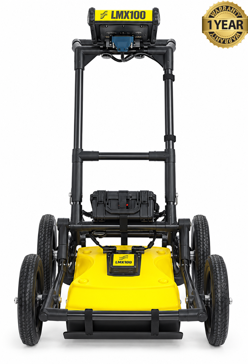

Sensors & Software LMX100 GPR Utility Locator
Condition: Refurbished / Calibrated
Warranty: 1 Year Warranty
Shipping: USA & Worldwide
- Sensors & Software LMX100 GPR Utility Locator (BC# -L/T*)
Sensors & Software LMX100 GPR Utility Locator
The Sensors & Software LMX100 is a ground penetrating radar (GPR) system made for locating buried utilities. An operator pushes its wheeled cart across the ground, and the instrument sends radar signals below the surface. Reflections from underground features appear on its touchscreen as a cross-section of the area being scanned.
The LMX100 helps locate both metallic and non-metallic objects. It can be useful for finding plastic pipes, concrete drains, cables, tanks, and other buried structures—especially when a utility has no working tracer wire. The operator looks for patterns in the radar image, then moves the cart back over a suspected target to mark its position on the ground.
Its 250 MHz ultra-wideband antenna is designed to balance image detail with depth penetration. Sensors & Software states that the LMX100 can collect data to depths of up to 8 m (about 26 ft) in suitable conditions. The depth of a detected object is calculated from the radar signal’s travel time, so correct soil calibration matters when estimating depth.
The LMX100 is designed for quick decisions in the field. Its high-visibility touchscreen shows scan results as the cart moves, and operators can save screenshots of areas of interest. Built-in GPS provides location information, while Wi-Fi and USB make it possible to share or transfer survey records.
In practical use, the LMX100 helps surveyors and utility crews investigate a site and mark likely underground services before excavation. It provides a visual record that can complement other locating methods, particularly for non-metallic utilities. Interpreting a radar reflection still requires care: the image helps indicate a buried feature, but does not automatically identify exactly what it is.
Features:
- Locates metallic and non-metallic buried utilities
- Uses a 250 MHz ultra-wideband radar antenna
- Shows a live cross-section of the ground on an 8-inch touchscreen
- Helps pinpoint a target by moving the cart back over its radar response
- Estimates target depth after soil calibration
- Has built-in GPS for location information
- Saves screenshots of survey results
- Offers Wi-Fi and USB for sharing or transferring results
- Uses a lightweight, wheeled fiberglass cart
- Runs on a swappable rechargeable battery
- Has an IP65-rated display unit for field conditions
- Can collect data to up to 8 m (about 26 ft) in suitable conditions
| Specification | Sensors & Software LMX100 |
|---|---|
| Product type | Ground penetrating radar (GPR) utility locator |
| Primary use | Locating and marking buried utilities and other subsurface features |
| GPR antenna | 250 MHz ultra-wideband antenna |
| Maximum data collection depth | Up to 8 m (26 ft) in suitable ground conditions |
| Data view | Live cross-section of a survey line |
| Target locating | Back-up indicator and depth estimation with soil calibration |
| Image enhancement | DynaQ dynamic stacking, DynaT target enhancement, preset filters, and adjustable gain |
| Display | 8-inch high-visibility color touchscreen |
| Cart | Lightweight fiberglass wheeled cart |
| Distance tracking | Integrated wheel odometer |
| Location | Integrated GPS/GNSS for geo-referencing |
| Data sharing | Wi-Fi and USB |
| Reports | On-site screenshots and Wi-Fi mini-reports |
| Power source | Swappable 12 V sealed lead-acid gel battery |
| Battery capacity | 9.0 Ah |
| Typical battery life | 4–6 hours |
| Charger input | 100–240 V AC |
| System dimensions | 100 × 70 × 115 cm (39.4 × 27.6 × 45.3 in) |
| System weight | 22 kg (48 lb) |
| Display ingress rating | IP65 |
| Operating temperature | −20 °C to 50 °C, per manufacturer’s technical specifications page |