
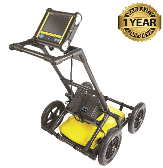


Sensors & Software LMX 200 Ground Penetrating Radar GPR
Condition: Refurbished / Calibrated
Warranty: 1 Year Warranty
Shipping: USA & Worldwide
- Sensors & Software LMX 200 Ground Penetrating Radar (BC# -L/T*)
- Battery Charger
- Power Cable
Sensors & Software LMX 200 Ground Penetrating Radar
LMX200 GPR complements traditional pipe and cable locators and allows you to locate targets below the surface. It is a high-resolution, compact ground penetrating radar designed for utility locating and forensic investigations. It provides real-time, non-destructive results to pinpoint both metallic and non-metallic targets like PVC pipes and fiber optics.
- Metal utilities, including pipes and cables
- Non-metallic pipes, including PVC and asbestos cement
- Concrete storm and sewer systems
- Utilities where installed tracer wiring has failed
- Underground storage tanks and drainage tiles
- Septic system components
- Fiber optic cables
- Non-utility structures such as vaults, foundation walls and concrete pads
Public utility systems and local governments require that the positions of underground systems are located and marked. This helps with planning projects and avoiding risks and hazards. The LMX200 builds on the capabilities of the LMX100 and adds further features to help you locate and map these utilities. It adds the powerful Grid Scan mode and the ability to use an external GNSS to take full advantage of SplitView and MapView. The LMX200 also allows data export for post-processing, archiving, reference and further mapping capabilities in EKKO Project
Features & Capabilities:
- In-field Depth Slices: Quickly visualize the position and depth of utilities by generating depth slices right on the touchscreen
- SplitView Display: View your line scans alongside map views or depth slices
- Dynamic Target Enhancement (DynaT): Optimizes views of targets of varying sizes (small, medium, large) and helps filter out background noise.
- Flexible Grid Collection: Guides you through setup with pre-selected grid sizes, with the ability to stop lines early, skip lines, or work around obstacles.
- Hyperbola-Fitting: Ensures accurate depth measurements by letting you back up over a target to calculate its depth.
Specifications:
| Sensor Frequency: | 250 MHz |
| Antennas: | Ultra-Wide Bandwidth (UWB) |
| Depth | Up to 8 meters (26 ft) |
| Data Storage | 380 km (236 miles) of data |
| Screen: | 8" color LCD |
| Storage: | Compact Flash card for recording snapshots and software upgrades |
| Dimensions: | 100 x 70 x 115 cm (39.4 x 27.6 x 45.3 in) |
| Weight: | 22kg (48lbs) |